Ok that was fun and tiring. I ran 13 miles including a 4.4 mile, 2200' ascent tempo run up Sanborn Road / Trail. In my quest to prepare for the USA Mountain Running Championships / Mt. Washington Road Race this June I've been seeking out long continuous, steep climbs for training. Mt. Washington is 7.6 miles and climbs 4200' on the auto road. There is nothing exactly like that in the Bay Area but there are a number of shorter road / trail climbs with a similar profile.
Prior to today the best profile matches I've found have been Black Mountain from Moody Rd (5 miles trail, 2400') and Montebello Rd from Stevens Creek Reservoir (5 miles road, 2000'). Today's ascent would be a bit different as the middle third of the route would be steep trail - much steeper and technical than anything on Mt. Washington. Regardless, it would be a fun challenge to have to change up tempo throughout the climb.
I started the climb at the intersection of Rt. 9 (West of Saratoga) and Sanborn Rd - about 800' above sea level. Expecting cool temps at the top I wore a Salomon EXO top, hat and gloves but feared I'd over-dressed as I started up the first mile in the sun.
The first 1.5 miles is paved; first on Sanborn Rd and then into the park up the camping area access road. After 850 vertical feet the pavement ends and the path briefly becomes a jeep trail before turning into a proper single-track. It was about this point where I noticed that temps had dropped and a light drizzle was coming down. Good thing I kept the gloves.
The next 2 miles were constantly changing in steepness as the trail wound up a ridge-line. In a few places the trail was flat but never consistent enough to get into a rhythm. Soon I reached the Skyline Ridge Trail and knew I was close to the high point. What i didn't know exactly (cause I hadn't looked at the map) was which way to turn on Skyline Drive to get to the 3200' high point. As I hopped up Biddles Stairway and onto Skyline Drive which way to go became obvious. Left = downhill and right = uphill.......so I turned right.
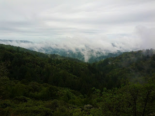
At this point I didn't know exactly how far it was to the high point. I knew what it looked like having been there last Fall with Dave Dunham to grab the Santa Clara County high point. Finally, after a half mile on the road I could see it through the mist and rain - the road leveled off and passed through a deep cut. My Garmin read 4.4 miles in 43 minutes and I was soaked. Below is a view West from Skyline Drive - after it stopped raining.
Now for the boring part of the run - getting back to the car. Since I'm a big non-believer in back-tracking I eliminated retracing my route as an option. This left two options - loop South or loop North. Since I'd run the South route once before I opted for the longer North route which descends Rt. 9 - a road I've biked down many times. Unfortunately what takes 15 minutes on a bike was going to take over an hour on foot. No matter; I slammed a couple FRS chews, water and off we go.
Lucky for me it got drier, warmer and less misty the further down Rt. 9 I went. By the time I reached Redwood Gulch Rd the sun was in full effect (pictured above) - nice! After 13 total miles and 1 hour and 50 minutes I made it back to the car. Looking at my heart rate data it was right in the zone 3/4 target. Hard but not eyes roll up in the back of your head hard. Mission Accomplished!
Beer me.


No comments:
Post a Comment